


Learn how geospatial technology is transforming the way we understand our world at this hands-on GIS and Environmental Data Workshop.
Participants will explore geographic information systems (GIS) and remote sensing tools used in environmental analysis and planning. Topics include:
- mapping land use and change over time
- analysing environmental risk data
- creating visual models of climate and habitat patterns
Led by Prof Olivia Davis, Lecturer in Environmental Data Science, this workshop is ideal for students and professionals looking to strengthen their technical and analytical skills.
Limited places — booking required.
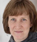
Prof. Olivia Davis is a highly respected academic in the field of Anthropology, who currently holds the position of Lecturer in Anthropology at Ludlow University in the UK. With over 20 years of experience...